Walking and Cycling in Spain (1 Viewer)

Dec 2, 2020
32
117
Forest of Dean
Funster No
78,283
MH
Autosleeper Talisman
Exp
Camper vans for 20 years until 2020 when we bought our first motorhome
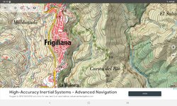
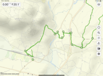
Hi, I've had a look on here but can't see an answer to this. When walking and cycling we use an iPhone and the OS app in the UK, and the excellent Oudoors IGN maps in France. They both give detailed offline mapping of lanes and paths - just like a paper map - as well as show you where you are. We have Tom Tom of course, but that doesn't give you proper mapping (to be fair it's not designed to, it's to get you from A to B). Google maps and Apple maps are pretty hopeless at that sort of thing, and anyway need a phone signal.

We are going to N Spain in June, and I wondered if any one knew if there was a Spanish equivalent of the OS or IGN GPS offline mapping available for smartphones?
 
Sep 26, 2013
4,165
5,129
Market Rasen
Funster No
28,295
MH
Self Build
Exp
Since 2003
I’ve been using Google maps in Spain on the iPhone but that might not have the detail you are looking for.
 

suavecarve

LIFE MEMBER
Aug 18, 2009
7,524
38,887
Surrey/Hants
Funster No
8,035
MH
Rollerteam 685
Exp
July 09
windymaps is good for UK and France, I suspect it is the same for Spain.

I back this up with Maps.me which is an all encompassing footpath finder offline gps map. Windymaps is better for the planning

Subscribers  do not see these advertisements


zaskar

Free Member
Sep 25, 2007
1,159
371
UK
Funster No
399
MH
5th Wheel
Exp
30+
AFAIK, there is no equivalent to the O.S system in Spain. This, apparently, goes back to the Franco days where it was illegal for anyone other than the military to own detailed maps. Over the past 10m year, some of the military maps have slowly been released to the public and are available in the UK from a co' in London (sorry can't remember name). I've purchased 2 or 3 for the Costa Blanca area and TBH, they're garbage and not on a patch on our O.S. system The best I've got now (and it really is fantastic) is a Garmin Edge Explore which is superb in detail for both walking and cycling.
 
Feb 18, 2017
4,129
7,995
Greenwich, London, UK
Funster No
47,382
MH
Hymer MLT 570
Exp
1986
In a word, No.

Unlike the UK, Spain does not have a single map source.
A variety of organisations, have, over different time periods, drawn up maps of different areas of Spain.
All of the maps are at different scales, each of the organisations use different symbols and each of the organisations had a different level of competence.

Some of the maps look like there were done by a teenage art class, others are fairly good, but not a patch on the IGN or OS.

Many years ago, whilst hiking in the Pyrenees we went up a road, that did not exist, and camped on a large hill that did not exist which overlooked a massive lake which did not exist.

It must be remembered that until the passing of the Franco era in late 1970's details maps were regarded as state secrets, the maps were only available to the military.

So in short, Spanish mapping is a mess.
The best place to get maps (In the UK or Spain!) is to go to Stamfords in Covent Garden in London.
They will have a selection of what you need, but dont expect to be able to get maps that join up, or are to the same scale, or that have been updated.

Subscribers  do not see these advertisements

 
Last edited:

suavecarve

LIFE MEMBER
Aug 18, 2009
7,524
38,887
Surrey/Hants
Funster No
8,035
MH
Rollerteam 685
Exp
July 09
Just had a look on windymaps and it does Spain. Contours visible
Screenshot_2022-02-09-17-56-36-31_c3ec9e6aca3b1ad714644dc286701d1d.jpg
 
Aug 20, 2019
1,723
12,081
Funster No
63,432
MH
Dethleffs Pulse
Exp
Motorhoming since 2020
We use Wikiloc. It's been brilliant and we've done some stunning rides and walks and we can send the route to our garmin or use it on the phone but that uses a lot of battery power.
 
  • Informative
Reactions: f6c
Aug 1, 2021
959
5,528
Pembrokeshire, UK
Funster No
83,135
MH
Auto-T Expedition 66
The "Spain Topo Map" app is the closest thing we could find to Spanish OS style mapping. Free with discreet ads in bottom bar, works fine with an Android phone or tablet. Don't know if also available for iOS. Scaleable and with GPS positioning. We used it last October and November for waking all over spain including in the Picos.

Subscribers  do not see these advertisements

 
Aug 1, 2021
959
5,528
Pembrokeshire, UK
Funster No
83,135
MH
Auto-T Expedition 66
Screenshot attached as to what it looks like using the 1:25,000 scale mapping. Not as good as GB OS mapping, but very usable. The App itself was very slick and responsive to use.
 

Attachments

  • Screenshot_20220209-181545_Spain Topo Maps.jpg
    Screenshot_20220209-181545_Spain Topo Maps.jpg
    544.6 KB · Views: 30
Mar 15, 2021
145
146
Funster No
79,789
MH
VW T5
We have only been one but used wiikilok then, however we have started outdooractive for OS mapping in the UK and they seem to have a good map of Spain. If your OS maps are near expiry it might be worth changing to Outdooractive, its about the same coat and the functionality is good from what we have seen. We are hoping to get to Spain in March and will be using a combination of both.
1644431061985.png
 

jumar

LIFE MEMBER
Nov 6, 2012
3,750
11,481
Spain
Funster No
23,578
MH
Hymer Tramp
Exp
Since 1994
Like others have already said...Wikiloc is a fairly useful App...but if used solely as a means to follow routes made by other members you might encounter a few hiccups along the way.....any mistakes made and not corrected could lead you to make the same..be mindful of this...other than this it remains a very useful tool.
We have a mapping agency in the Murcia region that produce good maps for this area..

Subscribers  do not see these advertisements

 
Jul 9, 2018
460
809
Funster No
54,839
MH
Globecar Campscout
Exp
since 2016
I've used Komoot a few times for cycling routes abroad.. 👌
 
Feb 16, 2019
563
1,525
Funster No
58,575
MH
Fiat PVC
Exp
Since 1995
we use a couple of apps for travel/walks and bikes.
Maps.me is great for our road travels as you can on your iPad place POI s on the map and then choose your route.
For walking we use GURU maps this works great as we track all our walks/rides , we can also swop the POI s with each platform.
The problem with recording where you walk/bike is when you go into shops buildings or stop for a longish time, as it tends to bounce the signal and can add to the distance traveled.
The image is a screen shot from the Guru app, near Loule , Portugal.

Subscribers  do not see these advertisements


Attachments

  • 0DBABFA3-3274-4BE3-97FF-5A7312DC0D93.png
    0DBABFA3-3274-4BE3-97FF-5A7312DC0D93.png
    3.5 MB · Views: 17
Sep 21, 2016
3,738
14,233
DERBYSHIRE
Funster No
45,235
MH
Frankia i740
Exp
since 2007
We use Alltrails just download the app, you can pay a little bit extra for it to send you a text if you go off track and it will divert you back on the right track. You can send a link to friends and they can follow you on it. First time Steve used it I Pmsl as he was just going round in the same circle for most of the walk. That's why I sent him on his own the first time to try it out :giggler:
 
Dec 16, 2017
1,226
2,504
Almuñécar, Spain
Funster No
51,665
MH
Low Profile - Globebus T7
+1 re the comment above regarding mapping here. We tried using the military ones for clients but the quality of the mapping is not good, and they lack the kind if details and scales needed for hiking or mtbing. Your best bet is to go to local tourist offices or the ayuntamiento (town hall) and see if there is a local product detailing routes. If you can find one for the area you will be in the Charles Davis books and accompanying waterproof map are, however, absolutely superb. Amazon product ASIN 1904946879

Subscribers  do not see these advertisements

 
  • Like
Reactions: f6c

jumar

LIFE MEMBER
Nov 6, 2012
3,750
11,481
Spain
Funster No
23,578
MH
Hymer Tramp
Exp
Since 1994
I've used Komoot a few times for cycling routes abroad.. 👌
I use Komoot too, it's good for route planning, however it's not over popular in Spain compared with Wikiloc...
 
Aug 20, 2019
1,723
12,081
Funster No
63,432
MH
Dethleffs Pulse
Exp
Motorhoming since 2020
We have only been one but used wiikilok then, however we have started outdooractive for OS mapping in the UK and they seem to have a good map of Spain. If your OS maps are near expiry it might be worth changing to Outdooractive, its about the same coat and the functionality is good from what we have seen. We are hoping to get to Spain in March and will be using a combination of both.
View attachment 584055
I have os map subscription but now we are spending most of our non working time in Spain we hardly ever use it so will look at switching. Does this have similar features/usability to the os app? I love the flyby feature on os maps.

Subscribers  do not see these advertisements


Join us or log in to post a reply.

To join in you must be a member of MotorhomeFun

Join MotorhomeFun

Join us, it quick and easy!

Log in

Already a member? Log in here.

Funsters who are viewing this thread

Back
Top