Ditto from me sorry it’s belated just doing some nocturnal catching up with your thread!Happy birthday Mrs DBK

Loving it Thankyou

Follow along with the video below to see how to install our site as a web app on your home screen.
Note: This feature may not be available in some browsers.
Ditto from me sorry it’s belated just doing some nocturnal catching up with your thread!Happy birthday Mrs DBK
") yesterday evening. We spotted a UK registered VW camper arrive at the aire just as it was beginning to get dark. I waved at them but didn't leave things at that but instead showed them there was room to squeeze in next to us as our pitch was quite wide. Nice couple with two young daughters. This is looking north east towards Étretat. So we drove back to the site with the intention of putting the laundry in the camp's machine, having lunch, hanging the laundry out to dry (they have no tumble dryer here annoyingly) then going for a walk to see the elephant. I suspect they didn't worry about such concerns in 1415.
yesterday evening. We spotted a UK registered VW camper arrive at the aire just as it was beginning to get dark. I waved at them but didn't leave things at that but instead showed them there was room to squeeze in next to us as our pitch was quite wide. Nice couple with two young daughters. This is looking north east towards Étretat. So we drove back to the site with the intention of putting the laundry in the camp's machine, having lunch, hanging the laundry out to dry (they have no tumble dryer here annoyingly) then going for a walk to see the elephant. I suspect they didn't worry about such concerns in 1415. Subscribers do not see these advertisements
Maybe to stop folk stealing the water lilies.Any idea why all the security at Monet's garden?
It was about 20 years ago when we last went I don't remember any security at all and easy to walk around with not many visitors.
Subscribers do not see these advertisements
I assumed it was to guard against any terrorist attack, like the sort they've had in Paris. They might have some specific intelligence of course and it isn't a "just in case" thing.Any idea why all the security at Monet's garden?
It was about 20 years ago when we last went I don't remember any security at all and easy to walk around with not many visitors.
Hear Hear! We go on the 18th.Loving your travels John the photos and detail are amazing , thanks for taking the time to post.
Safe travels John , Mrs DBK and Charlie!
The route was straightforward, back to the coast then turn right and follow the coastal footpath along the top of the cliffs. Total distance about 8km or 5 miles. Subscribers do not see these advertisements
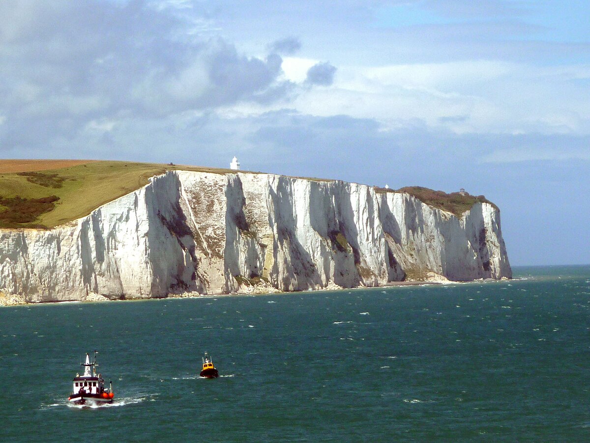
It's chalk with layers of flints and it just like you see at Beachy Head and around there. This bit of France is known as the Alabaster Coast and this page says they are part of the same geological formation as on the English side.Those limestone (I assume) cliffs are impressive,but not as impressive as those at Dover.........of course.
Is it actually the same rock formation? It’s a long while since I did A level geology.........which I failed.......the reasons for which are now obvious.
Subscribers do not see these advertisements
Looks great DBK,,will be docking in Caen next friday,,may spend a few days following your route,,thanks. BUSBY.We finally managed our walk to the elephant this morning.
This is looking west from the start of the coastal footpath section.
View attachment 329752
The tide is well out, compared to what it was like when we came here in the afternoon. The breakwater visible in the distance is an oil port according to the map. I guess this is where the tankers load and unload and there must be pipelines linking this facility to the refineries at Le Havre. I can only assume this is because the mouth of the Seine is too shallow and it keeps the big ships out of the way.
Walking east we spotted our destination in the distance. It is marked by a large arch known as the Manneporte.
View attachment 329760
You can just see a few figures on the skyline. We soon joined them because this is the best place to see the elephant.
View attachment 329762
And in close up.
View attachment 329765
The conical rock is l'Aiguille or the Needle, the arch is the Falaise d'Avel and it was the 19th century author Guy de Maupassant who likened it to an elephant dipping its trunk in the water. De Maupassant was born only a few miles from where we are tonight and he lived for a while at Étretat which is just the other side of the "trunk".
We drove along the coast after lunch, roughly following the line taken by Henry V's army in 1415, as shown in a post above. It is very open country with no large forests I could see or steep hills. But how would you move a large army? Modern maps show the route as a wide arrow but did they march on a broad front? They had carts for the baggage so these had to use the roads. But did the rest walk across fields and over hedges? I find this hard to believe, it would have been very hard going especially as it was frequently wet. I suspect they travelled on a single road with scouts ahead to warn of danger. But which road?
We have stopped tonight at Camping le Marque al, CC20327 and ACSI just short of Dieppe.
View attachment 329778
Unlike the last site this one has tumble driers and it is time for washing the towels and sheets. The weather is too unreliable at the moment for clothes lines. We washed lightweight stuff at the last place but the van looked like a laundry for a while as there was so much stuff hanging inside the van.
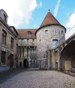
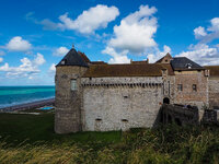
On the map above you might see a Musée de Dieppe, which is a large castle. We will try and walk there tomorrow, weather and washing machines permitting.
Subscribers do not see these advertisements
But I carried on writing the post then lost the lot. Nearly an hours work down the tube. This has happened before. I've been selecting and copying what I've written periodically in the past, so when it vanishes I can just paste it all back in, but I forgot tonight. Subscribers do not see these advertisements
I pressed the "post" button by accident above.
I'll see if I can work up the energy to redo it all.
Stuck at it....I can’t do half if what you put on here. Thanks for your efforts!I pressed the "post" button by accident above.
I'll see if I can work up the energy to redo it all.
Subscribers do not see these advertisements
Any idea why all the security at Monet's garden?
It was about 20 years ago when we last went I don't remember any security at all and easy to walk around with not many visitors.
 ). There are coach loads of foreign visitors arriving daily, many of them travelling from Paris. I suspect the presence of soldiers on the streets maybe to reassure the visitors that France is taking their security seriously. Similar security measures were on display at the Pau Grand Prix this year too.
Following once again roughly in the footsteps of Henry V's army we have moved up to the mouth of the Somme river and the aire, CC1322, at St Valery sur Somme.
View attachment 330258
And zoomed in.
View attachment 330257
This is a good aire with a number of EHU points, one of which we managed to secure.
View attachment 330252
It isn't as busy as I expected but the price, €12 a night, might be a factor.
A walk of twenty minutes or so brings you to the "sea front" of St Valery sur Somme.
View attachment 330254
A long boardwalk, overlooking the river, runs virtually the full length of the town. At the "landward" end is the tourist office where I got a map. Close by is the terminus of the steam railway which runs from here for a few kilometres to the coast at Cayeux sur Mer. From the timetable the next train wasn't due for another hour so I had to be content with a photograph of the (empty) turntable.
View attachment 330256
Looking across the river we could see several large parties of walkers.
View attachment 330260
The lot above are walking on the edge of the river, the others were on the salt marsh. I assume these are organised walks as this must be a dangerous place if you are not familiar with the tides and creeks.
The town in the distance is Le Crotoy where there is a CCP aire. This was an option for tonight but it is 3km from the town and has poor reviews. This place is much better for a similar price.
There are lots of smallish information boards around the town. This one was particularly interesting.
View attachment 330268
It describes the lugworm diggers who gathered bait for commercial fishing. At the beginning of the 20th century over 300 people were employed in this industry. They must have had to walk a long way each day to find new sand to dig.
The main draw here is the Medieval section of the town.
View attachment 330261
You enter it through the gate above. There are some ramparts overlooking the river you can walk along, which we did. They end at the "Tours Guillaume" where Joan of Arc was held briefly by the English on the way to her execution in Rouen.
View attachment 330264
We returned through the obligatory narrow streets.
View attachment 330266
View attachment 330265
As you enter the town there are signs announcing it as a "Ville Feurie" which is the French equivalent of Britain in Bloom. The normal ratings go from one to four stars and St Valery sur Somme has the four star rating! There is a higher gold category above this although I've never visited one.
But in honour of their achievement here are some flowers.
View attachment 330267
The award isn't given just on flowers alone but also green spaces, of which St Valery has plenty, the flowers weren't that obvious.
Subscribers do not see these advertisements
Following once again roughly in the footsteps of Henry V's army we have moved up to the mouth of the Somme river and the aire, CC1322, at St Valery sur Somme.
View attachment 330258
And zoomed in.
View attachment 330257
This is a good aire with a number of EHU points, one of which we managed to secure.
View attachment 330252
It isn't as busy as I expected but the price, €12 a night, might be a factor.
A walk of twenty minutes or so brings you to the "sea front" of St Valery sur Somme.
View attachment 330254
A long boardwalk, overlooking the river, runs virtually the full length of the town. At the "landward" end is the tourist office where I got a map. Close by is the terminus of the steam railway which runs from here for a few kilometres to the coast at Cayeux sur Mer. From the timetable the next train wasn't due for another hour so I had to be content with a photograph of the (empty) turntable.
View attachment 330256
Looking across the river we could see several large parties of walkers.
View attachment 330260
The lot above are walking on the edge of the river, the others were on the salt marsh. I assume these are organised walks as this must be a dangerous place if you are not familiar with the tides and creeks.
The town in the distance is Le Crotoy where there is a CCP aire. This was an option for tonight but it is 3km from the town and has poor reviews. This place is much better for a similar price.
There are lots of smallish information boards around the town. This one was particularly interesting.
View attachment 330268
It describes the lugworm diggers who gathered bait for commercial fishing. At the beginning of the 20th century over 300 people were employed in this industry. They must have had to walk a long way each day to find new sand to dig.
The main draw here is the Medieval section of the town.
View attachment 330261
You enter it through the gate above. There are some ramparts overlooking the river you can walk along, which we did. They end at the "Tours Guillaume" where Joan of Arc was held briefly by the English on the way to her execution in Rouen.
View attachment 330264
We returned through the obligatory narrow streets.
View attachment 330266
View attachment 330265
As you enter the town there are signs announcing it as a "Ville Feurie" which is the French equivalent of Britain in Bloom. The normal ratings go from one to four stars and St Valery sur Somme has the four star rating! There is a higher gold category above this although I've never visited one.
But in honour of their achievement here are some flowers.
View attachment 330267
The award isn't given just on flowers alone but also green spaces, of which St Valery has plenty, the flowers weren't that obvious.
There are undoubtedly prettier places in France but this isn't a bad place to visit.
Subscribers do not see these advertisements
Thank you for that, I'd heard it was now open but we'll still go and take things as we find them. There's a strong argument they've got the site of the battle wrong so it may not matter.I am assuming your destination is the visitor center at Azingcourt? Unfortunately they are rebuilding it and it was supposed to be completed by July- I have a holiday home locally and when I visited it 2 weeks ago it is still some way from being complete/ open.
Subscribers do not see these advertisements